Order for the Burial of the Dead
Submitted by Courtney Handy on Mon, 11/26/2012 - 16:49

Here is what I have so far of my map though I think it's pretty much done. Also I claimed that the capital of Hell, Pandemonium and the Island of The Tempest are London/England since I couldn't get over the fact they didn't have their own place and it made sense to me. After all, both end up violent places and liot talks of violence and crim in The Wasteland.
View The Wasteland: A Game of Chess in a larger map
For those who are working with Biblical references for the Waste Land wiki, here are a couple of helpful study resources!
Biblos is a fantastic site because it hosts a variety of different tools--an atlas for maps, greek and hebrew roots for word studies, commentaries, and a broad range of translations, among other things. Definitely a key tool for anyone studying the Bible for any reason.
Bible Gateway is a very good site for straight text study--it has different versions, cross-references, all sorts of fun stuff. Less fun tools than Biblos, better for reading through the actual text.
Hope you guys find these helpful!
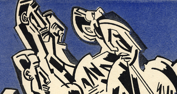
Searching for images related to "The Wasteland" I found this one with the first part of the poem, "The Burial of the Dead."

I created a rectangular shape to encircle the block around his house, where he spends the majority of his life. Then, I traced the roads to show an estimation of what path he took to reach the bazaar. Finding the train tracks was the most difficult part. I followed Northumberland Road because it was a different color than the rest, had arrows indicating what direction it goes, and went from the train station all the way to the bazaar. I also made the embedded map larger and in the terrain format to make it look less busy. The points on the Araby map already look crowded as it is.
View Araby Chivalric Quest in a larger map
A poem by Thomas Love Peacock. It is a mnemonic devised poem that helps children learn the history of England in a satirical way. After all, Thomas Love Peacock’s well known for his satire. I mapped only at the moment some of the places mentioned in the history of England. I still will have a lot of mapping to do. It is after all a long poem and many people/events are mentioned. The poem can be found in a link in my description for the map. Mapping in the way of the poem is interesting because it’s definitely a short history of England. It mostly has many events centered in England’s land while places not in England are far off. France and Palestine seem to be the only close places that are not in England. Mapping out this poem showed the distances of these ventures and I was able to see where they were located or at least closely located.
View The Round Table or King Arthur's Feast in a larger map
View The Romance of Araby in a larger map
I have taken some time to adjust my paths to a route the boy might have traveled, staying along roads and train tracks. What I am most interested in knowing is a bit more about how train tracks work, because I'm not entirely sure my train route is all correct. The bazaar is now represented by a pair of masks, indicating the mixed nature of that end to the boy's quest. I have also changed colours a bit, so that pink represents the neighborhood of his childhood, cyan the quest and the journey towards adulthood on foot, and red the same by train.
View The Romance of Araby in a larger map
What I found stood out most when I mapped Araby was the extreme smallness of his home neighborhood, when compared to the great distance he travels on his quest of romanticism. I started out very small--marking a tentative house for the boy, one across the street for the girl, the route to his school where he followed her every day... and then turned to searching for the train station. I was immediately struck by just how small a space he inhabits to start with.
Araby, of course, is commonly typed as a coming-of-age story, and this spacial sense of the story emphasizes this point even more clearly. Another common literary and philosophical trope arises as a result--that of the female as the civilizing, maturing factor for the male. Seen as far back as the Gilgamesh epic, where the woman Shamhat is presented as the civilizing influence who brings Enkidu out of the wilderness and makes him into a man, this idea of the woman's role is a critical one in literary tradition, one that I missed when I first read through Araby.
Mapping actually highlights this idea, by pulling the reader back far enough to recognize the incredible distance he travels in the name of the romantic quest, which of course results in his disillusionment and awakening to the real world. The girl, in this light, becomes a far more interesting, powerful character, one who is intimately involved with the process of his maturation, even if she is not actually sexually involved.
On another note, this mapping project revealed how many real places Joyce references in his short story. Although this is not entirely unusual for an author to do, it does make the story more realistic. The more points I marked on the map, the more alive and substantial the story became to me.
View Araby Chivalric Quest in a larger map
By mapping Araby I could see how long the boy's travel to get to the Bazaar was and it was long. Mapping the journey it was interesting to see where he traveled. Having gone to Ireland myself I remembered familiar places in Dublin and I can't believe that I didn't realize that places we probably passed were connected to Araby. So I find that really fascinating and it shows how mapping can help open up different views. By mapping Araby one can see how the story progresses and the feelings of the boy change. With the story being so short it’s not surprising that the journey of the boy felt short. Mapping out the journey I could see how the boy’s journey was actually long and it changed my view of how the boy began to change due to the coldness of reality.
View Araby Map in a larger map
I mapped the route from the boys house to the Araby Bazaar. I find it very interesting to see how far he had to travel to get to the bazaar and how far he was willing to travel for a girl. I am not sure if I mapped the route 100% correctly, but regardless the overall journey was rather large for a young boy. Today, the journey may not seem so far, but I imagine that it was much farther in his time.
View Araby Map in a larger map
During our lab, I put place marks in places I thought corresponded with Joyce's story. Also, I went to www.walkscore.com to look for a place that might serve as a market in Joyce's time. My best guess (at the moment) is Pearse Square. Take a look:
View Araby Route in a larger map
Here is a map showing the boy's walk down Buckingham St. to the tram, which he takes to Westland Row (now Pearse Station), and gets on a train (now the DART) to Sandymount, and then walks to the bazaar. It is color coded for mode of transportation (blue = walking; red = tram; green = train).
View Araby Map in a larger map
The Philbrook's collection was recently added to Google Art Project. Check it out!